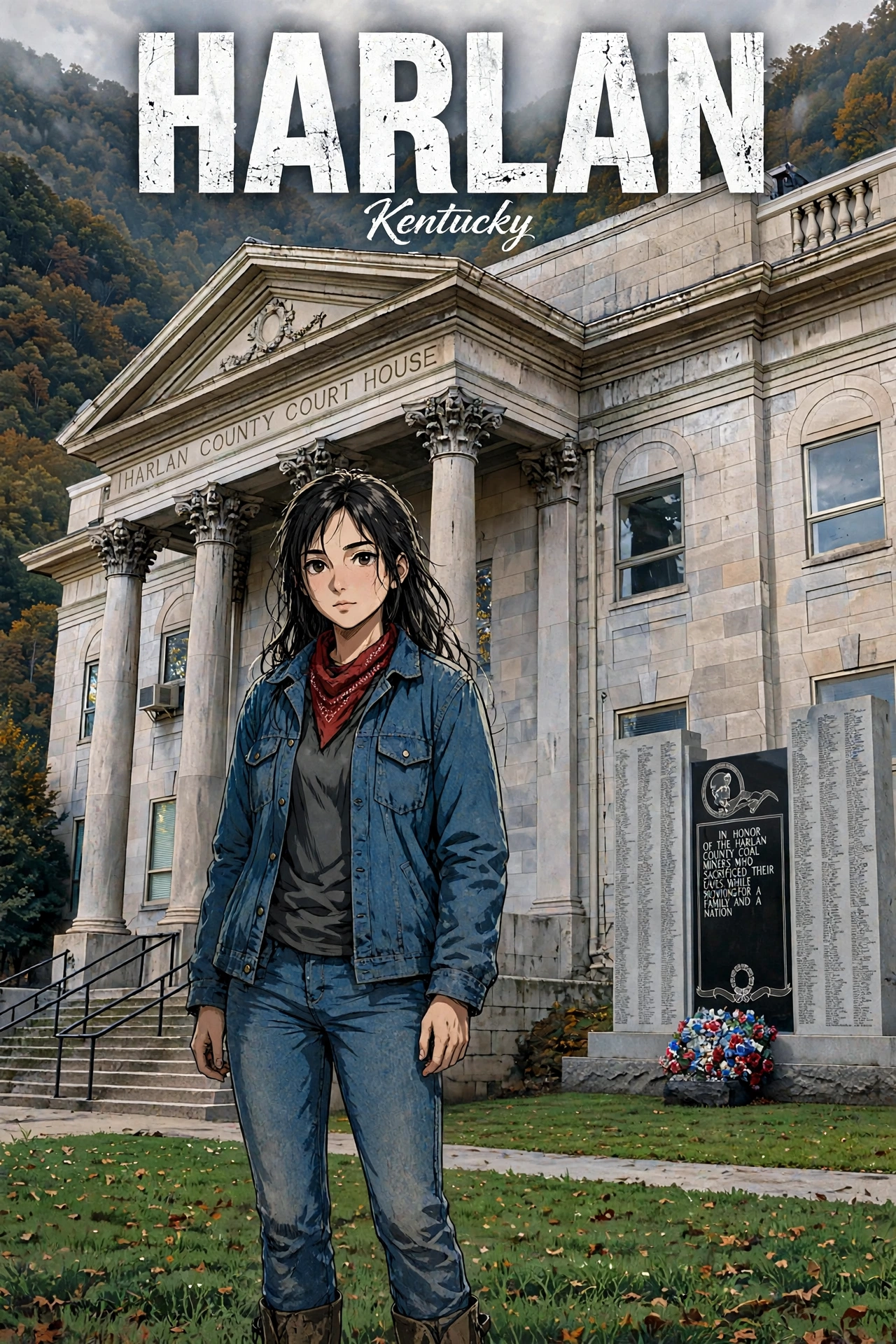
Drop 002
Named for her county. She is Harlan. The forks of the Cumberland, the railroad, the coal, the courthouse, the floods, and everybody who stayed.
“Named for her county. She is Harlan.”
Settled in 1796 as Mount Pleasant, she took her county’s name — the county named for pioneer Silas Harlan, killed at Blue Licks in 1782. The Louisville & Nashville Railroad arrived in 1911, the first carload of coal rolled out that August, and she grew to 5,122 by 1940. Bloody Harlan came to her county in the 1930s; the courthouse standing now, built 1918–1922, is the fifth on the same ground. The flood of 1977 sent the Clover Fork into tunnels under Ivy Hill. She’s down to 1,776 — still the county seat at the forks of the Cumberland.
County seat at the forks of the Cumberland. Bloody Harlan — the Harlan County War, 1931–39, was fought across her county; eight miners were sentenced to life after the Battle of Evarts.
36.85° N, 83.32° W
Tap the card for fast facts
She started as Mount Pleasant — settled in 1796 by Samuel and Chloe Howard, who gave twelve acres for the county seat when Harlan County was formed in 1819. The county carries the name of Kentucky pioneer Silas Harlan, killed at the Battle of Blue Licks on August 19, 1782, and the town took the county’s name for its own: Harlan Court House in 1828, Harlan in 1865, and Harlan in law on March 13, 1912. The Louisville & Nashville Railroad arrived in 1911, the first carload of coal rolled out on Friday, August 25, 1911, and the town grew from 657 people in 1910 to 5,122 by 1940.
The war came to her county in the 1930s — Bloody Harlan, the strikes, and the trials after the Battle of Evarts, eight miners sentenced to life — and the song “Which Side Are You On?” carried her name across the country. Her courthouse burned in the Civil War and rose again; the one standing now, built 1918–1922, is the fifth on the same ground. The flood of 1977 sent the Clover Fork into tunnels under Ivy Hill in 1989. The mines slowed, the people left, and she’s down to 1,776 — still the county seat at the forks of the Cumberland, where Black Mountain, Little Black Mountain, and Ewing Spur close in around her.
The Harlan County Courthouse on Courthouse Square, built 1918–1922, is the fifth courthouse on the same ground — Beaux-Arts, Indiana limestone, big columns. The Memorial to the Coal Miner stands on the lawn — a three-slab granite monument listing 1,320 miners by name (1912–2006), inscribed “In Honor Of The Harlan County Coal Miners Who Sacrificed Their Lives While Supporting A Family And A Nation.”
The first carload of coal left Harlan County by rail on August 25, 1911, and the town grew fast once the railroad carried the coal out. Coal runs through her story — the mines, the railroad, the memorial on the lawn.
Harlan, Harlan County, Kentucky
The county seat at the forks of the Cumberland — named for her county, and the county named for a pioneer. This is the history the Harlan card is built from.
Samuel and Chloe Howard settled the place in 1796, when it was known as Mount Pleasant. When Harlan County was formed in 1819, the Howards gave twelve acres for the county seat. The town sits where the Clover Fork and Martin’s Fork meet, in a narrow valley between Black Mountain, Little Black Mountain, and Ewing Spur.
Harlan is named for her county, and the county was named for Kentucky pioneer Silas Harlan, killed at the Battle of Blue Licks on August 19, 1782. The town took the county’s name step by step: the post office was called Harlan Court House from September 19, 1828, the town was renamed Harlan in 1865, and the state assembly changed the name in law to Harlan on March 13, 1912.
The Louisville & Nashville Railroad arrived in 1911, and the first carload of coal left Harlan County by rail on Friday, August 25, 1911. The town grew fast once the railroad carried the coal out — 657 people in 1910, 2,647 by 1920, and 5,122 by 1940, the most she has ever held.
The Harlan County Courthouse standing now, built 1918–1922, is the fifth courthouse on the same ground — Beaux-Arts, Indiana limestone, big columns. The Memorial to the Coal Miner stands on the lawn: a three-slab granite monument listing 1,320 miners by name, 1912–2006.
The war came to her county in the 1930s — the Harlan County War, the coal strikes, and the trials that followed. The Battle of Evarts was fought at Evarts, a separate town in the county, on May 5, 1931: three deputies and one miner killed, eight miners sentenced to life. Florence Reece wrote “Which Side Are You On?” in the middle of it, and the song carried Harlan’s name across the country. The 1976 documentary Harlan County, USA won the 1977 Oscar for Best Documentary.
The flood of 1977 was bad enough that the Clover Fork was diverted into man-made tunnels under Ivy Hill in 1989. A flood wall followed on the city’s west side along the US 421 bypass in the 1990s.
She’s down to 1,776 people in the 2020 census, still the county seat at the forks of the Cumberland. Harlan Independent Schools, a campus of Southeast Kentucky Community and Technical College, and the Harlan County Public Library branch are all here, and the historic commercial area is on the National Register. Every year, the Poke Sallet Festival brings folks back to town.
Comments
What do you think of Harlan? Say it here — comments show up once Dave gives them a look.
Loading comments…